Trails in McCall, ID
Lakes and rivers in McCall, ID frame a trail system that runs from Payette Lake’s shoreline paths and Ponderosa State Park’s peninsula loops to Bear Basin singletrack, Brundage Mountain hiking/biking routes, and granite-lined climbs in the Lick Creek range. Expect forested switchbacks, wildflower meadows, and alpine-lake outings with like trails Box Lake and Deep Lake—plus family-friendly mileage near town and winter Nordic options when the snow flies. It’s a four-season network with big views and easy access from the McCall core.
Meadow Marsh Loop
1.8 Miles | Easy
A flat, family-friendly boardwalk-and-dirt loop through aspen pockets, willow-lined marsh, and open meadow. Great for strollers and little legs with interpretive signs highlighting local flora and birdlife (watch for red-winged blackbirds, ospreys, and early-morning deer). Surfaces are mostly packed dirt with short boardwalk sections that can be damp in spring. Minimal elevation, plenty of shade, and frequent benches make this an easy warm-up or golden-hour walk.
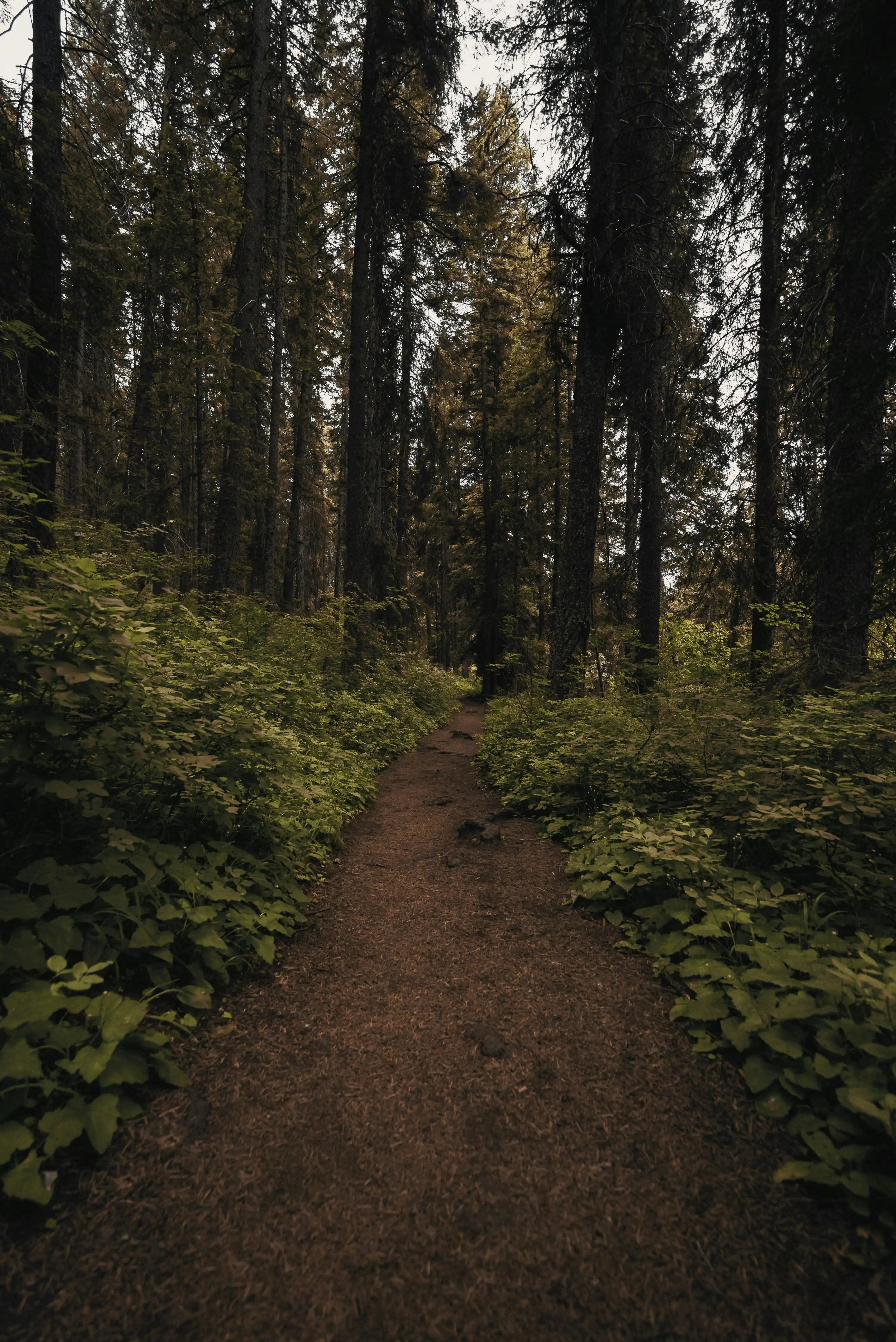
Payette Lake Peninsula Trail
4 Miles Out-And-Back | Easy
Shoreline singletrack tracing the narrow peninsula with near-constant lake views, big Ponderosa shade, and frequent side spurs to small beaches and rock outcrops. Expect gently rolling terrain with a few rooty sections; nothing technical. Perfect for a mellow jog, family hike, or sunset photo loop. Breeze off the water keeps bugs down most of the season. Popular—go early for quieter coves; carry sandals if you plan quick dips.
Ponderosa Ridge
~8.4 Miles Out-And-Back | Moderate
A longer sampler linking peninsula paths to higher forest benches for big-tree corridors, intermittent overlooks, and steady—but never steep—climbing. Expect packed dirt with occasional roots and granite fragments; drainage is good, so it’s a solid shoulder-season choice. You can turn around at any junction to tailor mileage. Great conditioning hike/run with shade, lake glimpses, and low crowds once you’re above the shoreline.
Deep Lake
~1.8 Miles Round Trip | Easy
Reached via Warren Wagon Road north of McCall, this mellow path winds through young forest regrowth and open wildflower meadows. The final approach brings hikers to a quiet alpine lake tucked between two 8,000-ft peaks. The terrain is mostly dirt singletrack with some loose stone, making it great for hikers and capable mountain bikers.
Josephine Lake
~1.6 Miles Round Trip | Easy
About 25 miles north of McCall, this short hike climbs gently through pine forest and open granite outcrops, with occasional stream crossings. The trail ends at Josephine Lake, a striking emerald pool set in a glacial cirque of granite ridges. Expect rocky footing in places, but overall smooth terrain that’s accessible for families.
Boulder Lake
~3.2 Miles Round-Trip | Easy-Moderate
South of McCall, the trail climbs steadily through dense evergreens, passing stream crossings and granite boulders before opening to Boulder Lake, framed beneath Boulder Mountain. The terrain is a mix of packed dirt, exposed roots, and smoother sections near the lake—ideal for hikers seeking variety without major challenge.
Box Lake
~6 Miles Round-Trip | Moderate-Difficult
This steeper climb begins at 5,600 ft and traverses granite switchbacks, wildflower meadows, and rocky ledges before cresting into an alpine basin. The footing includes loose rock and uneven steps carved into granite, demanding effort but rewarded by the sparkling high-elevation lake. Best suited for seasoned hikers and biking is not advised on the rocky ascent.
Granite Mountain Lookout
~5.6 Miles Round-Trip | Moderate-Difficult
The trail rises quickly through subalpine fir and wildflower meadows, with sections of exposed granite slabs. Switchbacks give way to sweeping ridge terrain leading up to the fire lookout at 8,478 ft. The terrain varies from dirt tread to rocky alpine ridges, offering panoramic views over Payette National Forest and nearby alpine lakes.
Goose Creek Falls
~2 Miles Round-Trip | Easy-Moderate
Just outside McCall, this short trail drops steadily through shaded fir forest and along creekside terrain, with soft soil underfoot and occasional roots. At the base, Goose Creek Falls plunges into a rock-lined gorge. The return hike is uphill, but manageable on a well-graded dirt path.
Brundage Bike Park
30+ Miles | Easy-Difficult
Lift-served downhill trails such as Elk Trail—a flowing, 6-mile descent through fir forests and granite features; and Hidden Valley, with technical chutes, jumps, and tight corners. Cross-country riders can enjoy the “best 12 miles of single track in McCall,” connecting trails like Rock Garden, Lakeview Vista, and the scenic Brundage to Bear Basin.
Jug Mountain Ranch
~15–20 Miles | Easy-Difficult
A playful, sculpted trail network ideal for progressing riders. Locals call Jug Mountain “Easily … the best flow trails in the area,” especially recommending South Boundary, North Elk Loop, and Elk Lollipop for beginners—all equipped with berms, rollers, and smooth flow transitions.
Bear Basin Trail Network
~25 Miles of Connected Trails | Intermediate
A diverse forested network, including Blue Ridge Loop and Grand Traverse, threading through dense pines and over gentle ridge terrain. The Drain Trail stands out for its standout berms and jumps, making Bear Basin a favorite among intermediate riders.
Tamarack Bike Park
~60 miles of Lift-Accessed Trails | Intermediate w/Technical Elements
About 10 miles from McCall, Tamarack Resort features extended flow trails and challenging segments with rock gardens, drops, and technical terrain. Riders noted that Tamarack “offers the largest variety and number of flow trails in the area,” with longer runs and lunar-dust soil that adds unique challenge and fun.
North Valley Rail-Trail
~10.5 Miles Round-Trip | Beginner
Starting in downtown McCall, this is a peaceful, family-friendly ride along the McCall Greenbelt and former Union Pacific rail line. The trail alternates between paved and dirt singletrack/double-track, flanked by wetlands and bird habitat—ideal for a relaxing, scenic loop.