Trails in Reno, NV
Trails in Reno, NV mix desert ridgelines with shaded creek corridors—perfect for hikers and mountain bikers. Start with the waterfall payoff on Hunter Creek Falls, sunset loops on Tom Cooke + Steamboat Ditch, and skyline views from Peavine via Keystone Canyon. For family-friendly miles, head to Ballardini Ranch and Huffaker Hills. When temps rise, cool off in the forested foothills at Galena Creek, Jones–Whites, and Thomas Creek. For flat, riverside miles, follow the Tahoe–Pyramid Trail through town.
Hunter Creek Falls
6.4 Miles Out-And-Back | Moderate
This is a creekside singletrack that climbs a rocky canyon with short punchy grades and a couple of easy seasonal crossings. Hikers get steady gain, some loose rock, and cooling shade near the waterfall (poles help on the descent), while bikers grind an intermediate climb dotted with baby-heads and enjoy a fun but busy descent—mind blind corners and foot traffic.
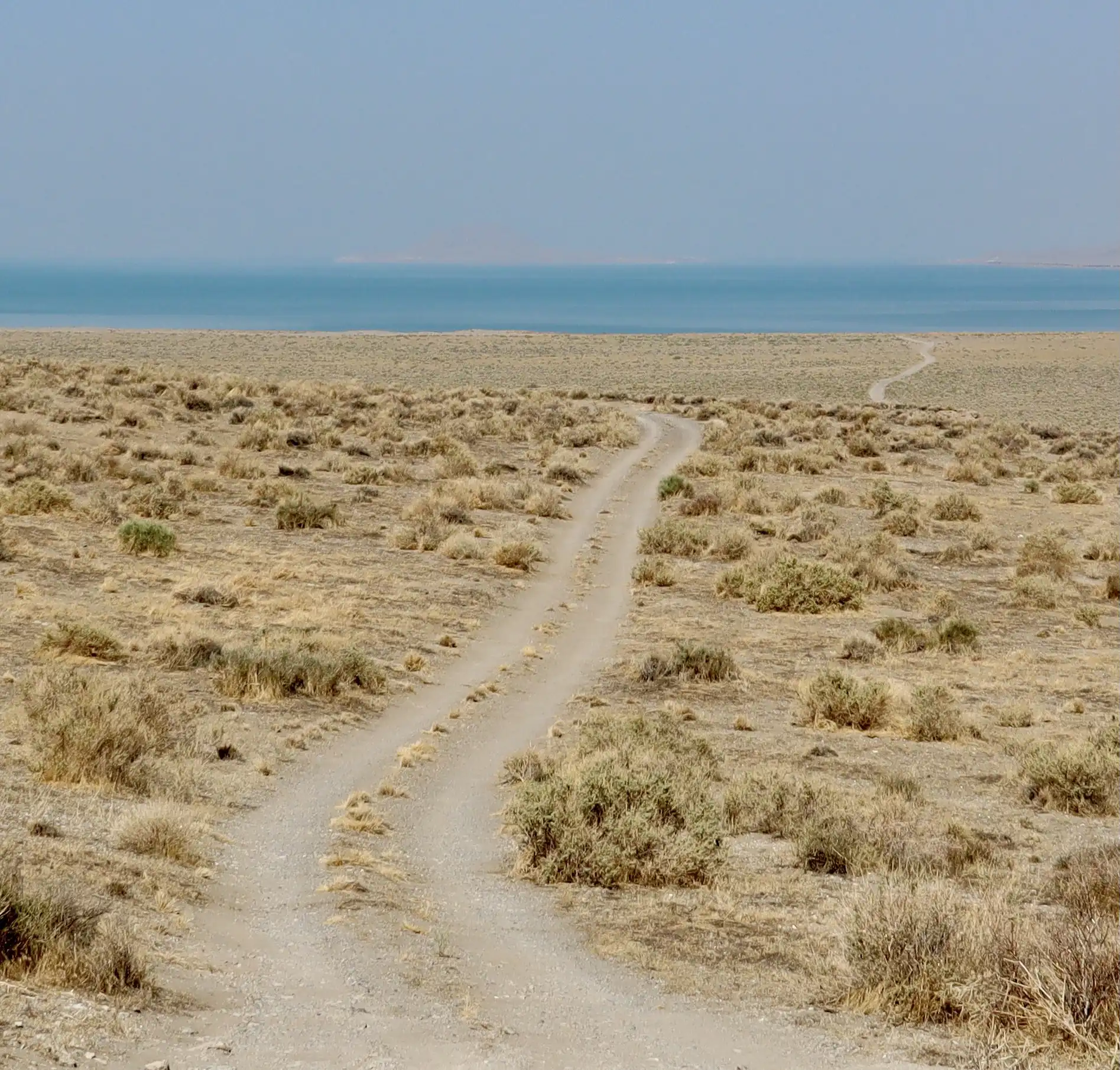
Tom Cooke + Steamboat Ditch Loop
4.5–6.0 Mile Loop | Easy–Moderate
A smooth desert singletrack links to the wide, flat Steamboat Ditch bench of decomposed granite—grippy when damp, marbly when dry. Hikers enjoy gentle grades and big Truckee River views while bikers get fast, flowy contouring with a few short climbs and optional tech spurs—an ideal after-work spin.
Keystone Canyon to Evans/Twah-Dadd
4-8+ Mile Options | Easy-Moderate
Open sage slopes and sidehill singletrack deliver city and Peavine panoramas. Hikers should plan for full sun and breezes on exposed ridges. Bikers find XC-style rollers, occasional exposure, and loose-over-hardpack corners—drop a bit of tire pressure for traction.
Ballardini Ranch Trails
2–7+ Mile Options | Easy–Moderate
Ballardini is a well-built, family-friendly singletrack meandering through high-desert meadows with granite outcrops and spring wildflowers. Hikers can stitch short, scenic loops perfect for kids and bikers enjoy green/blue mileage, great sightlines, and a few optional rock features for skills work.
Huffaker Hills Loop
2.0–3.1 Mile Loop | Easy
Packed-dirt trails circle two volcanic buttes with brief stair-step climbs and near-total exposure. Hikers get a quick cardio hit and 360° views of Reno, Mt. Rose, and the Virginia Range—prime at golden hour. Bikers get a short, zippy lap with firm tread and a couple of punchy kickers.
Hidden Valley Park
3–7+ Mile Options | Easy–Moderate
Rolling desert singletrack on decomposed granite with occasional sandy pockets and granite slabs frames wide Sierra vistas. Hikers can keep it mellow with mix-and-match loops and bikers enjoy flowing bench cuts and a few steeper connectors—watch for soft sand in dry spells and hero dirt after storms.
Galena Creek / Jones–Whites Creek Loop
8.8 Mile Loop | Moderate-Difficult
Forested foothills south of town offer creek crossings, granite steps, roots, and shaded switchbacks—significantly cooler in summer. Hikers get a classic long loop with varied footing. Bikers tackle big-day XC with techy creekside sections and rock gardens (it’s normal to walk a move or two).
Thomas Creek Trail
6.5–8.5 Miles Out-And-Back | Moderate
A gentle, steady grade follows a shaded aspen-pine corridor with smooth dirt and small roots, with links toward Whites/Jones for longer missions. Bikers get a blue-level climb and playful, non-technical descent—slow near pedestrians on narrow sections.
Peavine Mountain
6–12+ Miles | Moderate–Difficult
Big-open desert ridges mix jeep roads and singletrack with loose granite, ruts, wind exposure, and massive city/Sierra views. Hikers can pick their distance and should pack sun/wind layers. Bikers face fitness climbs and fast, loose descents, with advanced lines adding chunk and exposure.
Tahoe–Pyramid Trail—Reno Segments
3–15+ Miles | Easy
This is a mostly paved/gravel riverside path along the Truckee with minimal elevation change. Hikers get casual walks, stroller-friendly miles, and frequent river access. Bikers enjoy beginner-friendly spins and a scenic connector between neighborhoods and parks.